With Illinois gaining increased commercial ties after the War of 1812, the raising of livestock became increasingly common. Settlers no longer kept pigs, cows, and horses just for themselves, but also raised them for selling. Reynolds writes:
The farmers commenced to raise stock for exportation. Hogs and cattle crew in the river bottoms without much care or expense, and yielded a rich reward for husbandman. Horses were also raised for exportation, and money flowed into the country through these various channels to repay many fold the farmer.1
Livestock were the primary impetus by which agriculture in New England became commercial, and this was likely true for Illinois as well. Because they reproduced themselves, animals were among the easiest ways for farmers to raise surplus and earn profit. Bringing them from farm to the town market required the construction of roads, furthering the economic ties between urban centers and rural farms. This growing connection meant that more and more of the farmer’s work went towards selling products at market, both animals and crops.2
The pork industry was, in the words of Davis, “huge and had many linkages.” Live pigs and pork were transported to and from the market centers of Vandalia, Vincennes, Peoria, St. Louis, Cincinnati, and eventually Chicago, which in 1914 Carl Sandberg called the “hog butcher for the world.” There packinghouses would slaughter the pigs, turn their fats into soap and lotion, and ship pork to distant markets.3
Livestock were among the most valuable property farmers owned. Upon his death in 1833, Whiteside’s black horse sold for $50 at his probate auction, the second-most valuable item auctioned off, after a number of stacks of wheat that sold for $55. $50 in 1833 is roughly equal to $1,300 today.4 An individual lot of 22 pigs sold for $27.50. Though we do not know the total number of pigs he owned, all the pig sales together totaled $127.30. Finally, a cow and calf sold for $13.5 Pigs were so valued that, in the first decade of the nineteenth century, a man who killed a pig in Prairie du Rocher was tried for murder.6
With so much economic incentive to raise livestock, farmers could hardly afford to rely on crops alone. Thus livestock both promoted the expansion of capitalism, and capitalism promoted the expansion of livestock.
As more and more settlers raised livestock, they increasingly modified the ecosystem of the American Bottom, both directly and indirectly.
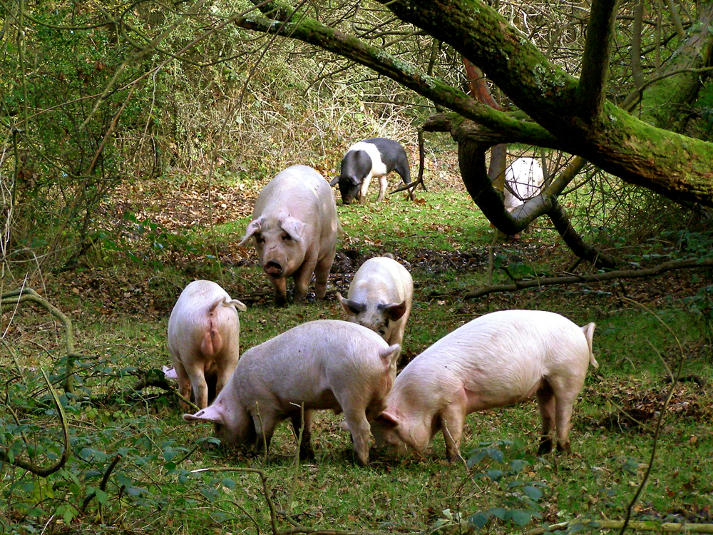
Instead of building fences, initially settlers let pigs range freely in the forest. Pigs will eat almost anything and, unlike cows, could survive attacks by wolves and bears. Rattlesnake bites rarely bothered them, and usually the pigs ate attacking reptiles.7 As a result, pigs rapidly altered the ecosystems of the forests they inhabited. In New England, livestock quickly devoured edible forest plants, leaving behind thorny, tough plants they could not eat. Through this artificial selection, pigs altered the species composition of the forests.8
Pigs and cows further led to the degradation of forests. As settlers cleared forests for wood and for use as fields, animals ensured the trees did not come back. Their hooves compacted the soil, reducing their oxygen content. This made soil less able to support plant life.9 In Illinois, the cows that grazed in the prairie prevented prairie fires, further reducing the prairie land in Illinois.10
Oxen and horses could pull plows, allowing for much larger fields than pre-Columbian Indians cultivated. Plows further disturbed the soil much more than Indian hoes and hands, destroying native plants. The new, larger farm fields were populated almost entirely by domesticated species of usually corn and wheat. These fields were perhaps the greatest ecological change from the land before.11
Because Anglo-Americans believed in fixed-property ownership, they frequently harvested from these same fields over and over, not practicing crop rotation. As a result, the soil became far less fertile, and with less organic material alongside deforestation, soil erosion increased.
With the exception of rice, which frontier settlers rarely planted, corn places a greater demand on soil than any other crop.12 Though settlers increasingly relied on wheat for their own food, they continued to grow corn not for their own consumption, but for livestock.13 Thus livestock further encouraged soil depletion, albeit indirectly.
Grazing animals were the primary instrument of spreading weeds. The new artificial ecosystems of farm fields and fields for livestock grazing became the habitat of a number of plant species. European grasses that evolved to withstand the demands of pastoralism quickly took the place of native grasses on grazing land. Some native plants became more common under American agriculture, especially ragweed. Most weeds came from Europe originally. Among the most notorious of these today is the dandelion.14
Possibly the most significant impact of livestock though was the large amount of land they required for pasture. Livestock required more land than all other agricultural activities combined. Hay and corn and wild edible plants could not keep up with livestock demand as they rapidly reproduced, requiring settlers to constantly clear new land for pasture. Settlers soon competed with each other for grazing land for their animals, pushing settlements further apart. As Cronon writes of New England, “Regions which had once supported Indian populations considerably larger than those of the early English settlements came to seem inadequate less because of human crowding than because of animal crowding.” Without livestock, he argues, American surpluses would have remained about the same level as Indians. With them, agriculture “had a constant tendency to expand and to put increasing pressure on its surrounding environment.”15
Livestock had an additional impact on the way settlers owned land, transforming it into a commodity. Pigs and cows were initially allowed to roam freely, but there was one place settlers did not want them: crop fields. Instead of enclosing the animals, farmers were responsible for fencing their crops. Laws tried to hold owners of livestock responsible for crop damage in Illinois.16 Towns took increasing responsibility for both maintaining the abstract boundaries between real estate properties and requiring these borders to be physically marked with fences. Through livestock, landowners’ property was strictly divided from each other, a major change from the common fields of the French.17
Land became a privately owned property not just because of livestock. For a variety of reasons tied to the change in the western economy from feudalism to capitalism over centuries, individual land ownership was becoming increasingly important for Americans, especially on the frontier.18 Owning land meant the boundaries of ownership had to be defined; in other words, it had to be clear what land was Whiteside’s and which land belonged to someone else. After years of difficulty delineating land ownership, especially in Kentucky,19 Congress passed the Northwest Ordinance, which divided the Northwest Territory into an abstract grid of perfectly-square townships, which were further subdivided into arbitrary sections, half-sections, and 160-acre quarter sections.20
In order to sell land though, surveyors had to survey it first. They first surveyed in Southern Illinois in 1806, reaching the Edwardsville Township in 1815.21 After the War of 1812, settlers could begin to purchase land in Illinois.22 Cronon writes, “By imposing the same abstract and homogenous grid patterns on all land, no matter how ecologically diverse, government surveyors made it marketable.” The grid transformed the land into a commodity to be bought and sold.23

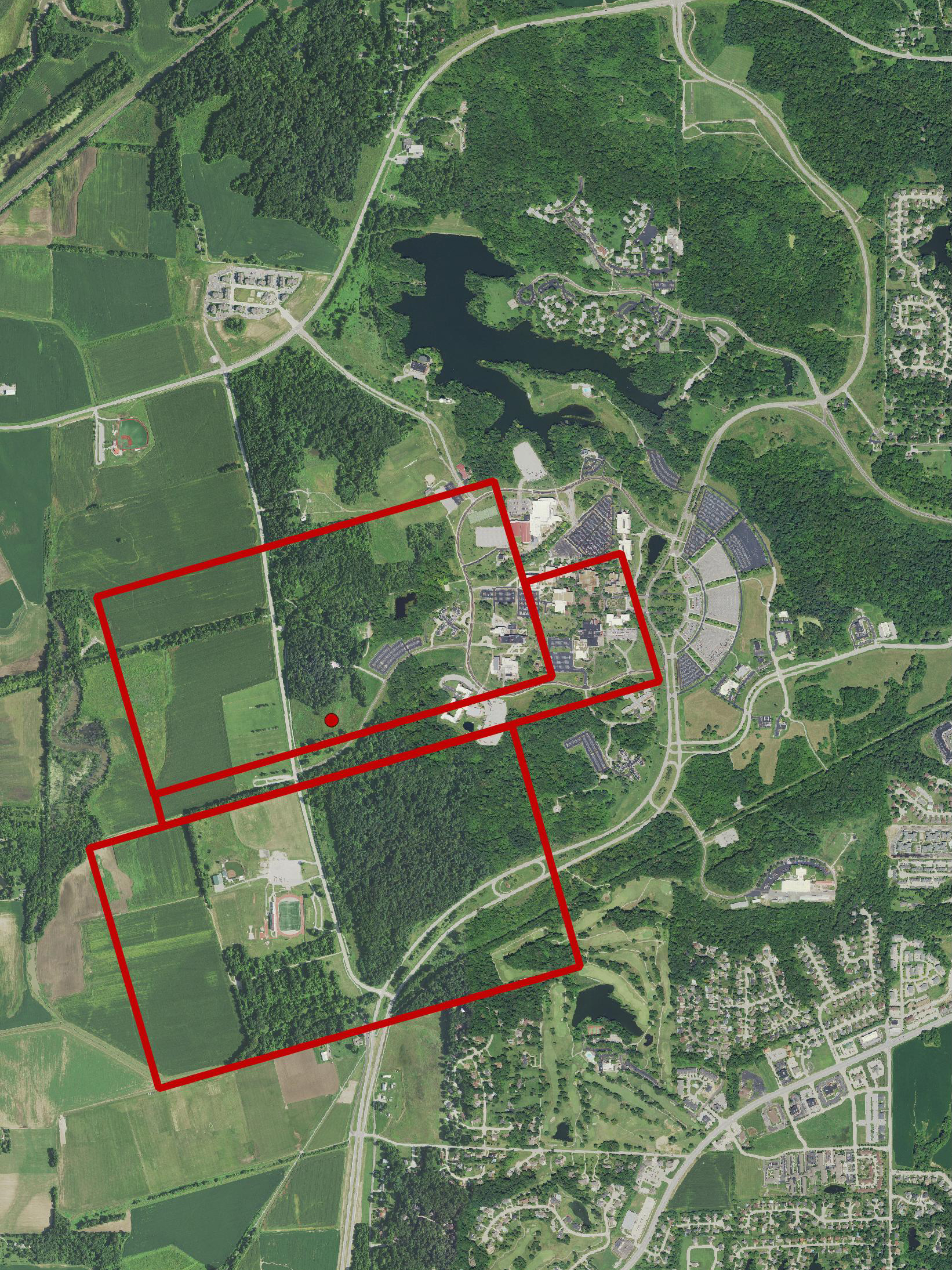
The land Whiteside owned does not perfectly fit into this grid. Instead, the three Whiteside properties lie diagonally against the grid and lie alongside Cahokia creek and the bluff line. They therefore place greater interest in the actual geography of the land, unlike the grid. The rectangular, long shape of his property resembles the earlier French long lots that ran back from river edges, though it also shows a transition to the Anglo-American grid. His lot is not nearly as long and narrow as French lots, yet it is also not a defined square or rectangle that follows range and township lines. Though his property starts to apply a geometric, European spatial order to the land, this order had not fully emerged. Not only does Whiteside stand at a border, he also is the critical juncture between a possible middle ground with Native Americans and the Anglo-American society that ultimately emerged.
As land became private property instead of common fields, settlers conceived of it differently. As the land itself, not just the resources on it, became a commodity, Americans oriented the land towards the production of resources for market. What the land provided did not just satisfy the immediate local needs of people in the American Bottom, it was meant to meet market demands from New Orleans, Philadelphia, Chicago, and beyond.
As settlers improved the landscape, their wealth increased. Even if they never traded surplus crops, livestock, or real estate at market, the economic value of their property increased as they raised more crops and animals. This value did not translate just into immediate use; it was worth abstract money value. The early capitalist system encouraged farmers to grow increasingly larger fields and herds, all to better provide for their family’s economic security. In turn this meant greater damage to the land.24
With the landscape incorporated into the grid, its very appearance changed; a shift visible even today. Illinois changed from a mosaic of forest, prairie, wetlands, and other ecosystems to rectangular farms and forests. The seemingly random arrangement of the natural landscape depended on its own disorder, yet Americans sought to impose a regular order and system to that randomness to suit their own needs.25
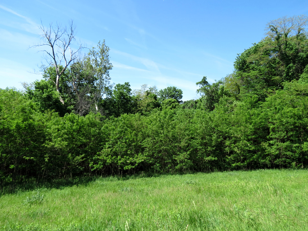
As they did, the borderlands between the ecosystems disappeared. Rigid borders between forests and farmland were established. These borders still exist today and can be seen at the edge of the SIUE campus as the SIUE Nature Preserve meets farmland.
For how Anglo-Americans reacted to the changing land after the War of 1812, see Statehood Ideology.
For a summation of the lasting impact William B. Whiteside had on the land, see Land After Whiteside.
1. John Reynolds, My own times: embracing also the history of my life (Belleville: B. H. Perryman and H. L. Davison, 1855), 176.
2. William Cronon, Changes in the Land: Indians, Colonists, and the Ecology of New England. (New York: Hill and Wang, 1983), 140.
3. James E. Davis, Frontier Illinois. (Bloomington: Indiana University Press, 1998), 130; Carl Sandburg, Chicago, 1914.
4. “1833 Dollars in 2013 Dollars,” In 2013 Dollars.com, accessed 2016.
5. Probate Court of Madison County, Illinois, In the Matter of the Estate of William B. Whiteside, Deceased. Letters issued to Jacob Swiggert, 1834.
7. Davis, 129; Cronon, Changes in the Land, 129.
8. Cronon, Changes in the Land, 144
11. Cronon, Changes in the Land, 147.
13. William Cronon, Nature’s Metropolis: Chicago and the Great West. (New York: W.W. Norton & Company, 1991), 99.
14. Cronon, Changes in the Land, 143.
17. Cronon, Changes in the Land, 135.
18. Stephen Aron, How the West Was Lost: The Transformation of Kentucky from Daniel Boone to Henry Clay (Baltimore: The Johns Hopkins University Press, 1996), 58.
20. Federal Township Plats of Illinois (1804 – 1891) site.
21. Ibid.; William Rector. “Township 4 North of the base line Range 8 West of the 3rd Principal Meridian,” plat map (October 18, 1815). Federal Township Plats of Illinois (1804 – 1891) site.
22. Douglas K. Meyer, Making the heartland quilt: a geographical history of settlement and migration in early-nineteenth-century Illinois (Carbondale: Southern Illinois University Press, 2000), 24.
23. Cronon, Nature’s Metropolis, 102.
24. Cronon, Changes in the Land, 77.
Made with Bootstrap and Glyphicons.
Borderlands: The Goshen Settlement of William Bolin Whiteside by Ben Ostermeier is licensed under a Creative Commons Attribution-NonCommercial-ShareAlike 4.0 International License.