In 1778, the violent stream of Anglo-Americans along the Ohio reached Illinois in George Rogers Clark’s famous Illinois Campaign, in which the Virginia militia officer captured British military installations in Illinois during the American Revolution.1 A number of veterans of Clark’s campaign either stayed in Illinois or returned later in life, bringing with them friends and family from places such as Virginia and Maryland. Bellefontaine and New Design were the first settlements Anglo-Americans established in 1779 and 1786 respectively; both located in the present-day Metro East of St. Louis.2 At this time, this region gained the name “American Bottom,” which encompasses the eastern floodplain of the Mississippi from modern-day Alton at the north to the Kaskaskia River at the south. It was likely named by these early Anglo-American settlers in the 1780s.3 The majority of them came from southern states such as Kentucky, Tennessee, the Carolinas, Virginia, and Maryland.4
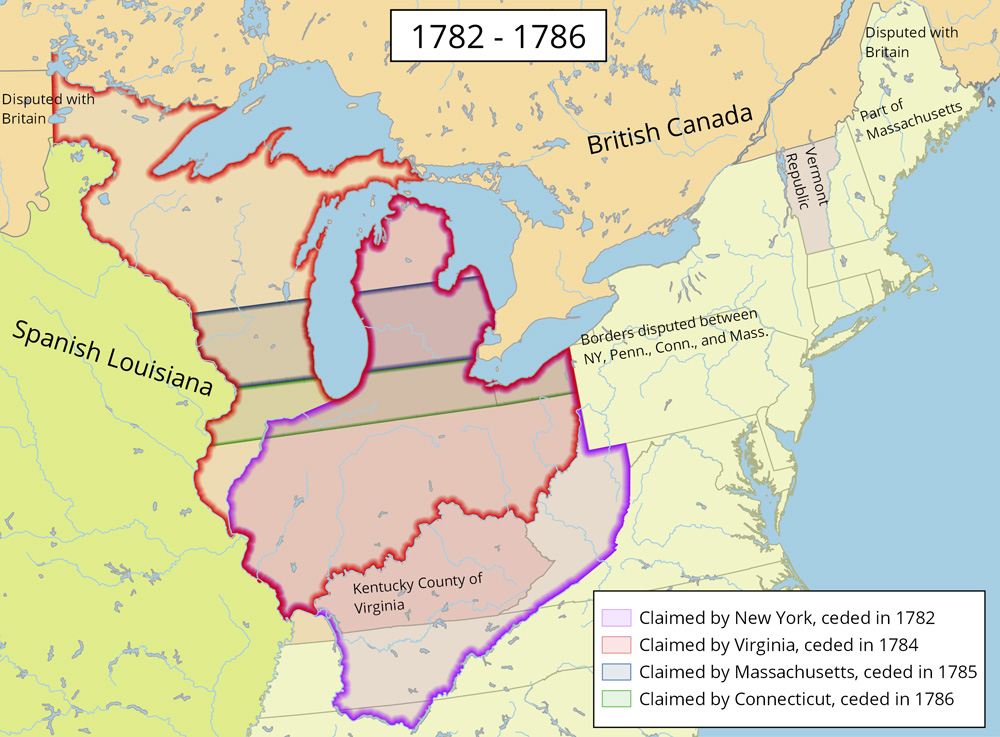
Officially, Illinois had become part of the young United States, with all territory south of the Great Lakes and north of the Ohio River granted by Great Britain in the 1783 Treaty of Paris that ended the American Revolution.5 With its territory doubled in size, the United States had to determine how to incorporate the region into the new union; its future became a point of contention among the states. After Clark’s expedition, Virginia claimed the region as the Illinois County of Virginia. Other states held claim to what would become Illinois, including New York, Massachusetts, and Connecticut. States without western claims, such as Maryland, refused to ratify the Articles of Confederation unless those states ceded their claims, which they eventually did. The federal government decided to carve new states out of the territory, including provisions for this process in the Constitution in 1787. The Northwest Ordinance, passed the same year the constitution was crafted, organized the territory as the Northwest Territory.6

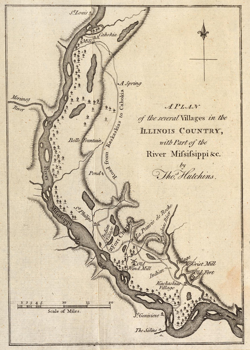
The Northwest Ordinance included provisions to placate French residents, including the maintenance of their land and property. They were exempted from Article 6, which specified: “there shall be neither slavery nor involuntary servitude in the said territory.” Yet despite this, many French migrated west to Spanish-led Louisiana as Anglo-Americans arrived. Many Anglo settlers had low opinions of the French, for they were Catholic, friendly with Indians, and foreign. In 1783 the French town of Kaskaskia had 155 French-speaking heads of families. By 1790, there were only 44.7
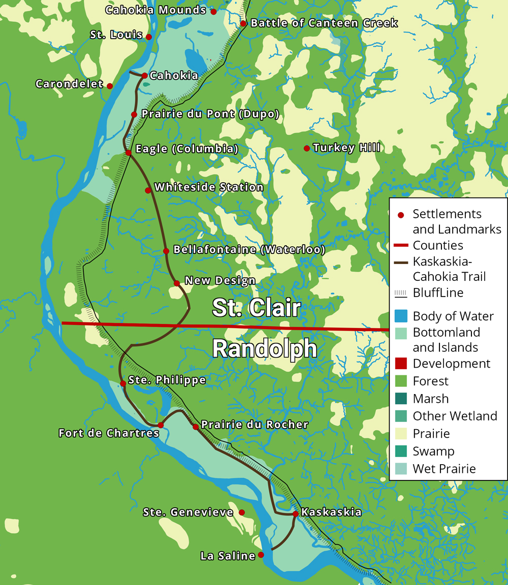
Yet however much they disliked the French, Anglo-Americans hated the Indians far more. Already tribes that had taken the place of the Illiniwek: the Kickapoo, Potawatomi, and others, harassed the French before Americans arrived.8 Kentucky settlers in particular brought with them experience in bloody warfare against Native Americans. For their part, Native Americans likely recognized the new settlers posed an even greater threat to their livelihood than the French. Indian groups frequently raided Anglo-American settlements, killed unsuspecting settlers, and stole horses. Whites led their own war parties against Indian villages, killing scores of Native Americans.9 Because of the danger, many Anglo-Americans built block houses or forts for defense from Native attack. One of these was Whiteside Station.10
The American military tried to quell Indian violence in the Northwest Territory. In 1790 General Josiah Harmer led an army of 1,500 into an ambush, with 180 killed. Northwest Territory Governor Arthur St. Clair led his own 3,000 man army in response, yet suffered even greater casualties. 630 died and 285 were wounded. Finally in 1794, General “Mad Anthony” Wayne won a decisive victory against Indians in the Battle of Fallen Timbers. This led to the 1795 Treaty of Greenville between American authorities and more than 1,000 Indian chiefs. Indians lost large chunks of Ohio, as well as the future locations of Peoria and Chicago. In return, Native American tribes received yearly payments in trade goods, making them further dependent on white authority. Native attacks became less frequent until the lead up to War of 1812. Though Indians largely remained in Illinois, the treaty set the stage for their removal.11
The Treaty of Greenville was joined by other critical treaties that year. The Jay Treaty forced remaining British troops out of forts in the Northwest Territory, while the Pinckney Treaty with Spain gave America navigation rights to the Mississippi and port access to New Orleans.12
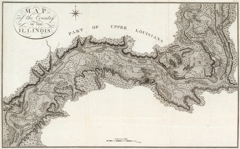
Because of Indian warfare, difficulties in travel, and lack of public sales of land, the Anglo-American population received only occasional reinforcements from Kentucky and other southern states. By 1800, the total non-Indian population of Illinois was about 2,500, with lingering French making up about 1,500 of the population. The remaining 1,000 were Anglo-Americans, most all of them concentrated in the American Bottom. Four American settlements had sizable numbers. The largest was New Design with an unknown number of people, 250 in Eagle, 186 in Bellefontaine, and 90 in Fort Massac at the southern tip of Illinois. About 334 lived in various settlements, forts, and farms mostly in what would become Monroe County. The rest lived among the French in Kaskaskia, Cahokia, Prairie du Rocher, Peoria, and others.13 Another population lived in the American Bottom as well: enslaved African Americans. Though the northwest ordinance had explicitly banned slavery in the territory, many southerners brought their slaves with them to Illinois, either ignoring the law or “hiring” their slaves as “indentured servants” for decades. The French too were allowed to keep their slaves. With limited government authority and high demand for labor, slavery was allowed to persist in Illinois.14
1. James E. Davis, Frontier Illinois. (Bloomington: Indiana University Press, 1998), 24 - 26.
2. Douglas K. Meyer, Making the heartland quilt: a geographical history of settlement and migration in early-nineteenth-century Illinois (Carbondale: Southern Illinois University Press, 2000), 19 - 20.
4. The vast majority of Illinoisans were from the south in 1818. Davis, 159.
9. For example, the Whitesides participated in various raids on Indian groups, most notably in the Battle of Canteen Creek, in which they killed, at most, 60 Indians. See John Reynolds, The pioneer history of Illinois (Chicago: Fergus Printing Company, 1887), 188.
10. Reynolds, The pioneer history of Illinois, 131.
Made with Bootstrap and Glyphicons.
Borderlands: The Goshen Settlement of William Bolin Whiteside by Ben Ostermeier is licensed under a Creative Commons Attribution-NonCommercial-ShareAlike 4.0 International License.