
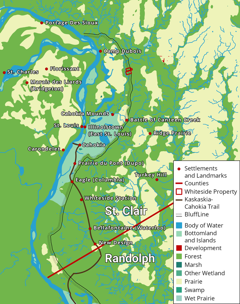
Now with access to the Mississippi River and threats from Indians lessened, Anglo-American settlements in the American Bottom expanded. Many migrated out from the forts and blockhouses to establish homesteads and farms. In 1802 two settlements were established to the north of previous settlements in what would become St. Clair and Madison Counties: Ridge Prairie and the Goshen Settlement.1
Further ties were also established with the growing port city of St. Louis. With the Mississippi now open to American traffic, Captain James Piggot established the first American ferry to St. Louis across the Mississippi in 1795. Economic and social ties cemented further with the Louisiana Purchase in 1803, with St. Louis becoming an American city. The purchase also altered the American Bottom’s relative location, which became centrally located as an access point to the west.2 For instance, the Lewis and Clark expedition spent the winter of 1803 and 1804 training at Camp Dubois, in what would become Madison County, before beginning their expedition west on the Missouri River.3
The federal government acquired another territory in 1803: the Saline Creek salt springs near Shawneetown in eastern Illinois. Though not as grand as the Louisiana Territory, the salt works attracted further settlement into Illinois. Shawneetown acted as a gateway into the deeper territory of the American Bottom, with some settlers using it as a stop on the way to the American Bottom. In general, the American Bottom extended connections through St. Louis and Shawneetown. Farmers sold their surplus crops to markets through these connections, sending them by flatboat or keelboat up and down rivers. These markets were primitive however, with slow transportation and limited communication, so the profit from selling crops was fairly small.4
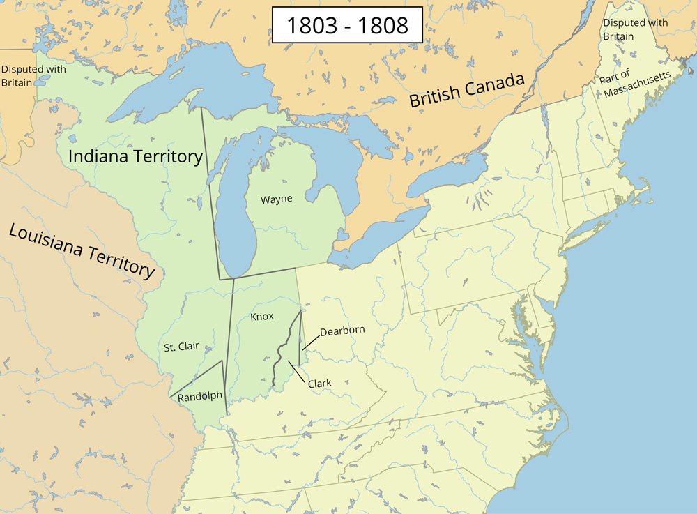
All of these factors led to a steady increase in Anglo-American population as more settlers arrived and children were born. It increased by a factor of 12 from about a thousand in 1800 to 12,282 in 1810.5 Because of the population increase and with Ohio close to statehood, the Northwest Territory was reorganized. The Indiana territory was created in 1800, including land that would become Indiana, Illinois, Michigan, Wisconsin, and parts of Minnesota. Ohio itself became a state in 1803. Illinois was made its own territory in 1809.
1. Reynolds, The pioneer history of Illinois, 314.
3. University of Nebraska Press / University of Nebraska-Lincoln Libraries-Electronic Text Center, The Journals of the Lewis and Clark Expedition.
Made with Bootstrap and Glyphicons.
Borderlands: The Goshen Settlement of William Bolin Whiteside by Ben Ostermeier is licensed under a Creative Commons Attribution-NonCommercial-ShareAlike 4.0 International License.